System of record
Feature services, enterprise geodatabases, and identity — Esri still owns the operational GIS layer for many federal and utility orgs.
Enterprise GIS where the system of record still wins.
ArcGIS Enterprise, Online, Pro, and the Maps SDK for JavaScript — the stack behind CDC, utility, Census, and IC/DoD work I've shipped for 15+ years.
Esri / ArcGIS playground
Why Esri
Most of my career lives here: Portal, Server, geodatabases, Python ETL, and secure web maps. This lab is where I show modern Maps SDK patterns on top of that foundation.
Feature services, enterprise geodatabases, and identity — Esri still owns the operational GIS layer for many federal and utility orgs.
Modern web clients can sit on the same services as ArcGIS Pro. I use that bridge for dashboards, editing tools, and Vector Ledger–style workflows.
ArcPy, REST admin APIs, and scheduled ETL remain how large agencies keep layers trustworthy at scale.
TS/SCI environments, Portal auth, and network isolation change how you design maps. This hub will document those constraints honestly.
Built with Esri
Live client work stays private. Public demos and architecture notes will land here alongside Vector Ledger.
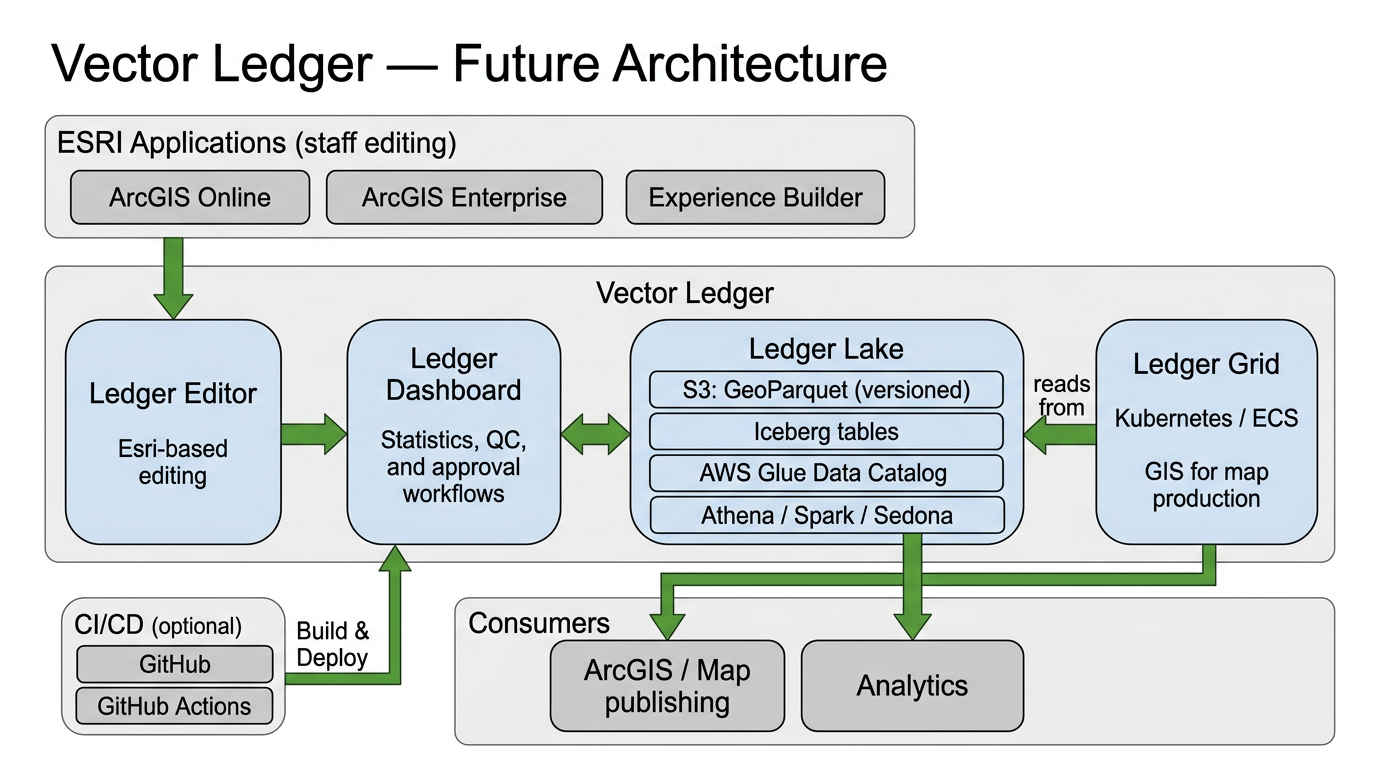
ArcGIS-connected editing and validation with lakehouse patterns — Iceberg, GeoParquet, and changelog history.
Visit Vector Scope AI →A public Maps SDK for JavaScript lab — layers, popups, and editing patterns without client data.
Coming soonPlatform labs
Mapping and cloud playgrounds — each hub explains why I use the platform and links demos as they ship.